

English

Español

Italiano
PONENTE PRINCIPAL
10 Novembre 2016
Aula Magna dell'Università degli Studi di Firenze
Piazza San Marco, 4, Firenze
| 10.30 | |
La torre de la Illeta en la defensa de la costa de Alicante, España. Estudio histórico y evolución constructiva |
|
 |
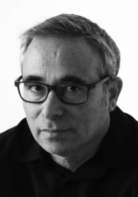
Pablo Rodriguez-Navarro |
| Universitat Politécnica de Valencia, Valencia, Spain | |
Abstract - The Illeta Tower is located near El Campello city (Alicante) on a small plain, a few meters from the sea, between the Clot de l' Illot located on the south side of the tower, and Almadrava beach located on its northern part. Its location seems to coincide with the position occupied by an ancient medieval tower, now disappeared that had the function of protecting the settlement in the Illeta dels Banyets, today connected to the coast by an artificial isthmus with an important archaeological site, which was occupied on the Iberian period and later with the Roman presence. The Illeta Tower, like many other coastal towers, was built during the reign of Felipe II, as part of the defense system of watchtowers of the eastern coast of the XVI and XVII centuries. Built between 1554 and 1557, it consists of large format blocks in his first three rows and in the rest ashlars. It has a circular floor and piramidal form, highlighting the rest of watchtowers for its dimensions and geometric characteristics. Consists of a single room covered by a dome, which is currently accessed by a metal staircase built in the intervention in 1991. Also from this period are the brackets and breastplate as a garland tops its walls limiting its cover, element that contrasts sharply with Acuña claims and the images earlier than its restoration. Through the historical study, the morphological analysis, the interpretation of its constructive system and by reading the walls, we will do the study of the tower, determining its transformations, and approaching through graphical analysis to knowledge of the original tower.Pablo Rodríguez-Navarro (Valencia 1963) es Profesor Titular de Universidad del Departamento de Expresión Gráfica Arquitectónica de la Universitat Politècnica de València (España) (UPV) desde 1994. Fue en esta Universidad donde obtuvo el título de Arquitecto Técnico. Posteriormente se licenció en Historia del Arte en la Universitat de València, completando su formación con el grado de Ingeniero de Edificación por la Universidad de Castilla-La Mancha (España). Es profesor visitante del Politecnico di Milano y de la Università degli Studi di Firenze. Desarrolla su investigación como miembro del Instituto de Restauración del Patrimonio de la UPV. Doctor en “Expresión Gráfica Arquitectónica” por la UPV, con la calificación de Cum Laude y Premio Extraordinario. Vencedor del Premio Internacional de Investigación Ibn al-Abbar en el 2010. Especializado en el levantamiento digital, a través del uso del escáner láser, fotogrametría arquitectónica, uso de drones, post-procesado de la imagen y modelado 3D por ordenador. Interesado en la arquitectura fortificada, ha liderado varios proyectos sobre arquitectura de tierra en Marruecos. Actualmente dirige el proyecto nacional sobre las torres de defensa de la costa valenciana (siglos XVI al XVIII) denominado TOVIVA Project. Presente en los comités científicos de prestigiosas revistas y congresos como Disegnarecon, VSMM, Digital Heritage, Digital Applications in Archaeology and Cultural Heritage, CIATTI, Arqueologica 2.0, FORTMED,… Su producción reciente se puede consultar en:
|
|
| 11.10 | |
Torri e fortezze del Mediterraneo nella cartografia nautica della Marina militare francese (seconda metà XVII - metà XVIII secolo) |
|
 |
Anna Guarducci |
Università degli Studi di Siena
|
|
Abstract - This work comes from an accurate research in the archives of Paris. It aims to underline the importance of Mediterranean Marine Atlases realized by the “hydrograph engineers” of French Navy since 1679. These atlases (especially handmade) are very different from traditional small scale nautical maps of medieval and modern age. French atlases characterize themselves as original and exact surveys, made always from the sea; they were characterized by drawings and maps about specific subjects, like: harbors and coves, fortified cities and single towers (overall, perspective or plan views). Among all, the first “Portolano-Map of Mediterranean Sea” stands out: six handmade atlases drown by the engineers Nicolas Pène and Jacques Pétré in 1679-1686, on clear information from minister Colbert and from the king Louis XIV himself. At the time France was at war against Spain, England and Netherlands and she needed the most exact maps of “Mediterranean theatre”; therefore, these atlases are real geo-political and military instruments.Anna Guarducci es profesora asociada de Geografía en el Departamento de Ciencias Históricas y de el Patrimonio Cultural de la Universidad de Siena desde el 2005, adonde ha llevado adelante su actividad docente desde el 1999. En el 2014 obtuvo la Habilitación Nacional como Profesor Ordinario. Graduada en la Universidad de Florencia (1993), y Doctorada en Geografía Historia y Organización del Paisaje y el Territorio (Florencia 2002), con la tesis “El sistema de termas toscanas desde el Medioevo a hoy. Geografía Histórica y patrimonio cultural”. Conduce actividad de investigación científica desde el 1993, frecuentemente en colaboración con administraciones locales de la Toscana y ha participado a la realización del “Plano de Dirección Territorial de la Toscana para el Plano del Paisaje” coordinando el grupo de trabajo sobre los “Paisajes Históricos” y sobre “Procesos Históricos en edad moderna y contemporánea”. Las líneas de investigación conciernen: temas y problemas del paisaje, del ambiente, del patrimonio cultural y de la historia del territorio (con particular interés para la Toscana), además del análisis y censo de las fuentes geos-históricas, en particular la cartografía de los siglos XV-XIX. Es responsable científico del proyecto “Imago Tusciae. Catalogo digital de la Cartografía Histórica de l Toscana” (www.imagotusciae.it) y Toscana Tirrenica (www.toscanatirrenica.it). Da las actividades de investigación científica han sido producidas mas de 90 publicaciones (ediciones de algunos volúmenes, artículos publicados en revistas especialistas, volúmenes de grupo, actas de congresos), entre las cuales algunas monografías como Atlante della Toscana tirrenica. Cartografia, paesaggi, architetture, Livorno (Livorno, Debatte, 2012) e Torri e fortezze della Toscana tirrenica. Storia e beni culturali (Livorno, Debatte, 2014). |
|
| 11.50 | |
La trasformazione veneziana di Ravenna: la Rocca Brancaleone (1457-1470) sulla chiesa di S. Andrea dei Goti (518) |
|
 |
Alessandro Camiz |
| Girne American University, Cyprus | |
Abstract - Perhaps for the effects of the damnatio memoriae that followed the Agnellian censorship of Arian churches, Ravenna completely forgot the Church of the Goths; yet numerous documents allow us to locate its remains. It was a massive circular building with a central plan created on the ruins of a Roman building, as described by the Chronicle. The Arian bishop Unimundus built the church out of town in the XXIV year of Theodoric’s reign (A.D. 518). According to another source, Theodoric himself built the church near the Tremedula gate and the church of S. Stefano de Oliviis. The church was rededicated to St. Eusebius after being converted to the Catholic cult. The title reported by Agnellus, in our opinion, refers to the Catholic rededication, as well as the Arian Cathedral of Pavia, also rededicated to St. Eusebius. Near the church in the IX cent. a monastery dedicated to St. Andrew was built. The building itself is described as Ecclesia Gothica in another part of the Chronicle within the architectures that Theodoric built during his reign and cited in numerous other medieval notarial documents as ecclesia gothica. In the fifteenth century during the construction of the Rocca Brancaleone, the defensive system of the city incorporated the building, turning it into a dungeon. This architecture is a singular example of continuity of use from the first century to contemporary times, its original function of thermal conditioner, possibly part of a Roman thermal plant, was maintained, so as to retain the title of the ice tower (torre della ghiacciaia), in spite of a total cancellation of the collective and historical memory of its existence. All consulted authors, needless here to repeat the entire list, but already the Rossi referred to the church as demolished, report the building as demolished for the construction of the fortress, which cannot find any documental or material confirmation. The architect dismantled the stone cladding and used it for the foundations of the fort, but preserved the core wall. It is an exceptional material document, perhaps the only Gothic building in Ravenna not having suffered heavy nineteenth-century restorations and preserved to this day thanks to the new Venetian use.Alessandro Camiz, Ph.D. (1965, Roma-Italia), Arquitecto, Jefe del Departamento de Arquitectura de Interior. Prof. Dr. en la Facultad de Arquitectura, Diseño y Bellas Artes, y Director del Centro Internacional de Estudios sobre el Patrimonio, Universidad Americana de Girne, Chipre. Director de investigación de la Asociación para el Diálogo y la Investigación Histórica (AHDR), y miembro fundador de la Red de Chipre Morfología Urbana (CyNUM). Experto en diseño arquitectónico y urbano (Prof. Giuseppe STRAPPA, "Sapienza" Universidad de Roma) y profesor adjunto en la Escuela de Arquitectura de la Universidad de Miami. Ha colaborado con Sartogo Architetti Associati en varios proyectos, como la Nueva Cancillería de la Embajada de Italia en Washington DC (1993-2001), Nueva urbana y la Universidad de Bolonia-Lazareto (con R. Meyer, 2000), Cheung Kong sede de la búsqueda de grupo, Hong Kong (2001), Iglesia parroquial de S. Volto di Gesù, Roma (1998-2006), Roma Interrotta-Uneternal City, XI Bienal de Arquitectura de Venecia (2008). Es miembro desde 2003 de la Historia de las Ciudades (fundada por Enrico Guidoni), desde el año 2007 del International Seminar on Urban Form y desde 2014 de ICOMOS Italia. Sus intereses principales son la morfología urbana, las teorías arquitectónicas y tipológicas, en la época medieval y la historia urbana moderna, la conexión entre la arqueología y la arquitectura contemporánea. Miembro del Consejo Editorial de la Universidad Girne American Journal of Social y Ciencias Aplicadas y de Phlogiston, Journal of the History of Science, Museum of Science and Technology, Belgrade. Ha realizado sus estudios post-doctorales en el Departamento de Arquitectura de la "Sapienza", Universidad de Roma, obteniendo su Ph. D. en Historia de las ciudades en "La Sapienza", Universidad de Roma y una Maestría en Ciencias en Arquitectura de la "Sapienza", Universidad de Roma, Italia. Es autor de libros y artículos sobre la “Urban morphology”, “Il tesoro delle città”, “Storia dell`urbanistica”, “Schifanoia, a cura dell`Istituto di studi rinascimentali di Ferrara”. |
|
| search engine by freefind |
|
|
|
|||


